
So, yesterday's walk and tour was a really interesting day. These pictures might look a bit dull and boring but it was the stories and history and line between what is known and what is unknown that made it so fascinating.
Here is some "official info"
In 1991, the Province decided to extend Special Places Protection to the site , pending further study. Despite a number of suggested explanations by various experts, the most popular being that it may have been a British military training and practice area from the post-1749 period, no fully satisfactory explanation for the site has yet to emerge. The main site, consists of approximately 150-metres of snaking carefully-built dry-stone wall of varying height and width, generally following the brow of a high ridge, along with the remains of two dry-stone polygonal building foundations. The smaller of the two foundations abuts a tall vertical cliff face and includes a stone staircase. Recent investigations in the Chain Lakes Watershed Area to the east of this have revealed a collection of enigmatic ruins that appear to be linked to each other, and to the main walls site, by the remains of a highly unusual type of road network. Despite the fact that most typical sorts of development have been prohibited in this area since it was set aside for the purpose of the City Water Supply in 1846, these enigmatic ruins must be distinguished from the many relics of Colonial activity throughout the area, including damming, road building, pipeline and canal construction, the railroad construction in 1904, electric power corridors, quarrying, woodcutting, hunting, a known homestead site, a known WWI entrenchment and machine gun installation, and recent recreational activities. We need to also be aware that a Mi’kmaq medicine woman was known to reside in this area and that there may be other relics of Aboriginal occupation to be found.
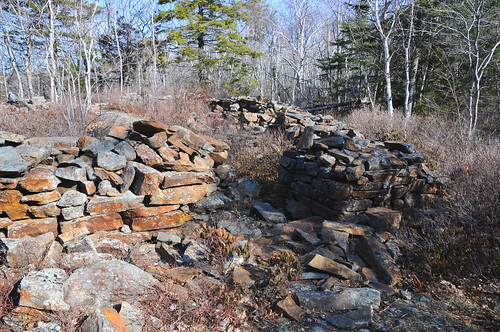
This is the five sided foundation of the largest of the ruins. No one knows who constructed it, what it was used for and when it was made.
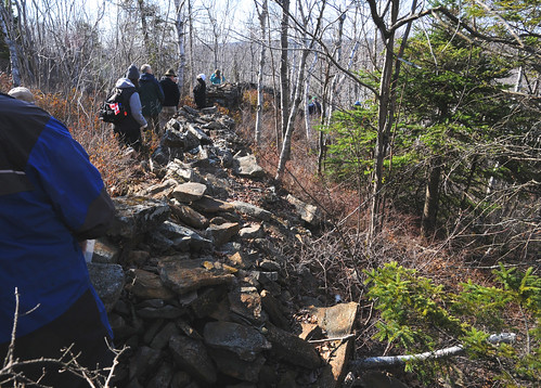
We then walked along the walls themselves. They are disintegrating and the cap stones that once lined most of the length are gone now, perhaps harvested by later settlers. The walls hug a high ridge and are built along the curve of the hill. At the highest point there is a small spur wall, and remains of two others that might form a small lookout post.From this vantage one can see out to the lakes and beyond.
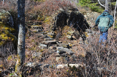
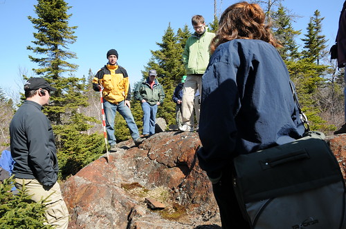
One of the smaller foundations with a small crumbling stair way that has been destroyed by trail bikes. The stairs lead to a high point of rock beyond which is the walls and a fire pit on the stone embankment. The man in yellow is Terry Deveau who led the tour.
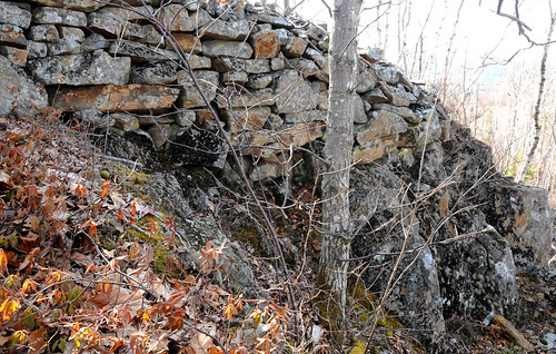
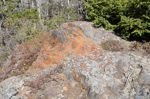
Close up you can see how the rock has been changed by the heat. Made flaky hard and shiny and black with carbon. You cannot really see in this picture. I would have just walked past and thought it was natural weathering and iron leaching out of the rock. The fires would have been huge and seen for miles up on this hill. There are a few of them.
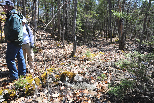
This is an ancient road that runs from the ruins. You can see it's route through the trees. Here it appears quite obvious but it is in the middle of the woods and is hard to follow unless you know what to look for. You can see the shoring up of the road bed to make it level as it runs along a book. There are several of these roads that intersect. They are older than the roads built by founders of Halifax. When Halifax was founded every road was documented and none of these are anywhere on the earliest maps available. Several of the "newer"(250 year old) roads, cross over these older ones. Quite mysterious:)

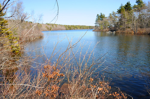
This is the possible homestead of Isabelle Dodo ( not sure of the spelling) She was a revered Mi'kmaq Medicine woman who lived alone in a wigwam on the small point of land between the two Chain lakes. A lovely spot. When she died, she was carried to Guysborough County and buried on an island in the St Mary's River.
I am just scratching the surface of all that we saw and learned. I am looking forward to going back and having a further look see. HERE is a link to all the Flickr pictures if you want more:)


10 comments:
That all sounds terribly intriguing. Is this site near Halifax itself?
It is actually within the city limits near a large industrial park and the watershed area.They are not allowed to develop it for the time being because of it's unknown origins.Thank goodness!
That is awesome! I love that stuff! Thank you for sharing.
wow, that's really cool, thanks for sharing. i had no idea... and i live, um, really close to there :)
Shelagh,
Pace has been a bit frantic the last few days. It was nice to slow down and take a walk with you. Really interesting. I especially like the tidbit about Isabelle. I'm glad she's on an island in the river. I could easily be happy living in the woods in a hut. Except maybe for that Heath bar craving I have every few months. That would be difficult. And your pictures of food blow me away everytime! This one was no exception.
That lady's last name sounds like it might be Googoo. A familiar L'nu (Mi'kmaw)name in NS.
Hi Wejitu, I thought her name was unusual too but it is indeed Isabelle Dodo. I checked it again before I posted:)
Hi, Shelagh! Your "mystery tour" sounds so fascinating! Looks like a great day in the woods to me! :-)
Hi! I live in Halifax and have never heard of this area! Is this a guided tour that you can sign up for? It sounds so interesting, I would like to go myself. Your blog is great. I've seen your photos at Love, Me Boutique and was excited to realize the connection. :)
Christine
How fascinating! I love adventures like this. I hope that more is learned abi=out these ruins and thay will be protrcted. Maybe it was from ancient Vikings?
Post a Comment